Q&A: Beth Copeland '06 Studies the Effects of Climate Change on Mount Rainier

Beth Copeland '06
Details
In 2001, an avalanche of rocks and mud tore through a popular hiking destination at Oregon's Mount Rainier. Due to climate change, these debris flows could become more common, the result of shrinking glaciers exposing unstable rocks in their wake. Beth Copeland '06, a graduate student in water resource engineering at Oregon State University, has been part of a research team studying Rainier's past debris flows in order to better determine future occurrences. Recently, she answered some questions about her work:
Haverford College: How did you become interested in this field?
Beth Copeland: I saw a photo of a bridge on Highway 35 in Oregon where boulders were piled up to the guardrail after a debris flow.
HC: What does your project involve?
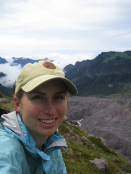
BC: I spent the first part of the summer, while much of the mountain was still snow covered, looking at aerial photographs that were taken pre and post the November 2006 storm [which caused a 100 year flood and closed Mount Rainier National Park for an unprecedented six months] in order to identify possible locations of debris flow damage. The snow has finally melted enough to allow field work during the second part of the summer. I hike to where the debris flows start and characterize/map the geometry of the initiation. Several of the drainages that experienced debris flows in 2006 had not historically had debris flows, so the big question is whether the characteristics of debris flows are changing in some way as a result of less late summer snow cover, warmer fall rain storms, or glacial retreat.
HC: How exactly are shrinking glaciers heightening the risk of debris flows?
BC: When glaciers retreat, they leave large steep-sided piles of material (moraines) that are prone to collapse. Glaciers at Mount Rainier also strand large masses of ice as they retreat. Saturated soil created by melting ice can be easily eroded. This story of this stagnant ice in the park is amazing; it is hard to map because it's seldom visible above ground, but it plays an incredibly important role in the formation of debris flows. Near the Emmons Glacier, there is ice likely from the 15th century that is melting underground, causing the water level in a nearby lake to rise.
HC: During your time in Oregon, have you seen debris flows becoming more frequent?
BC: Tom Deru of the Forest Service has records that show debris flows becoming more frequent on nearby Mount Hood, but the verdict is still out for Rainier. We're certainly seeing them in places they haven't historically been recorded.
HC: Is there a correlation between debris flows and poor weather?
BC: Yes. Debris flows either start during abnormally hot, dry summer weather and are assumed to be caused from a“burp” of water from the glacier (glacier outburst flood) or debris flows start during fall rainstorms before the ground is snow-covered.
HC: What, besides flooding, are the significant risks posed by debris flows?
BC: Damage to roads and buildings, and worse, fatalities of hikers or campers if they cannot evacuate to higher ground.
HC: Can anything be done to prevent future flows?
BC: We can't stop debris flows but we can stop building or rebuilding in floodplains or river bottoms.
HC: Has your involvement in this study made you more environmentally conscious than you already were?
BC: For me, being part of the park service demands maintenance of a balance between protecting a natural ecosystem and ensuring visitor access. I find it to be incredibly meaningful work.


