Mapping the Past: Catie Curry '10 Plots Renowned Photographer's Route Through Mexico

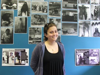
Catie Curry with photographs Paul Strand took in Mexico during the 1930s; they will be included in Jim Krippner's book, along with Curry's map.
Details
“When I agreed to be Professor Krippner's research assistant,” says Catie Curry '10,“I never thought I'd be making a map!”
Yet that's just what Associate Professor of History Jim Krippner asked her to do: create a map of the Mexican cities and sites photographer Paul Strand visited in the early 1930s for his Mexican Portfolio. Krippner plans to include the map in his forthcoming book, tentatively titled Paul Strand in Mexico, 1932-34: A Journey with Pictures. The book will reconstruct in detail Strand's years in Mexico, while also offering insights into Mexican cultural history.
The goal of Curry's map, says Krippner, is to“provide the best way to represent the real places that Strand travelled through and photographed, helping us more precisely situate the images he constructed.”
Working from a list of 20 cities that appears on the front page of Strand's Mexican Portfolio, as well as from letters and photograph captions, Curry began by researching the cities' existences. Some were difficult to find, as their names had changed in the ensuing decades; for example, the present-day city of Oaxaca was in the ‘30s called Oaxaca de Juarez in honor of revolutionary hero and former president Benito Juarez.
Curry also searched far and wide to locate the road Strand traveled from Laredo, Texas to Mexico. Her research unearthed the Pan-American Highway, the Mexican portion of which (called the Inter-American) was built in '33.“It fit the parameters, trajectory, and time period of Strand's route,” she says.
To draw the actual map, she used mapmaking software called ArcGIS, which is available on every computer in Magill Library. Assisted by Laura Allen, the library's Coordinator for Research, Instruction and Outreach, Curry first created two preliminary maps, one with outlines of Mexico's cities and one outlining its states. She then arranged a spreadsheet of the cities, plotting the latitude and longitude of each. The map she eventually sent to Krippner's publisher pinpoints the cities themselves, with the states outlined.
“Catie demonstrated perseverance and ingenuity in tracking down [all of the] places,” says Krippner.“Her research was essential because it freed up time for me to write during the fleeting summer months.”
Developing the map has given Curry a clearer sense of what most interested Strand as he shot his portfolio.“He was drawn to many smaller, rural towns,” she says.“He stayed south, away from the American border. He was looking for towns with more of a Mexican feel.”
Krippner plans to give Curry credit for the map when his book is published in August of 2010—coincidentally, Curry's birthday month.“The only present I want is a copy of the book with my name in it!” she says with a laugh. -Brenna McBride


